STAKEHOLDER
INVOLVEMENT IN
WATERSHED-BASED PERMITTING:
The Penobscot River Example
by
David Mitchell, P.H.D.
Senior Ecologist
ENSR
Ken Gallant
Senior Environmental Engineer
Champion Paper Company
Watershed-based decision-making has become
increasingly important in the development of discharge permits
throughout the nation.
Numerous states have reorganized their water quality planning
and permitting sections along watershed boundaries to coordinate data
collection, facilitate analysis, and synchronize permit issuances,
including development of Total Daily Maximum Loads (TMDLs) for
impaired waters identified under Clean Water Act (CWA) Section 303(d).
The development of a TMDL for the Penobscot River, Maine
provides a good example of the challenges inherent to watershed-based
planning and the need for stakeholder input.
This paper highlights the activities of the Penobscot River
Basin Dischargers Council (PRBDC), a private, voluntary group of
industrial and municipal dischargers, during the development of the
TMDL.
Early involvement by PRBDC members in the Penobscot River TMDL
development was important due to the wide and divergent spectrum of
stakeholders in the basin.
PRBDC activities included: preliminary discussions with
regulatory staff, input on river sampling work plans, involvement in
river and effluent discharge sampling, evaluation of sampling results,
and comments on the draft TMDL.
Click here to view
the
entire TMDL Study

Penobscot
Watershed
New
England's second largest river system, the Penobscot drains an area of
8,570 square miles. Its West Branch rises near Penobscot Lake on the
Maine/Quebec border; the East Branch at East Branch Pond near the
headwaters of the Allagash River. The main stem empties into Penobscot
Bay near the town of Bucksport.
The river
is tidal from the base of the Veazie Dam to its mouth near Bucksport
(approx. 25 miles) and is brackish to the town of Hampden. The river's
total fall from Penobscot Lake on the South Branch is 1,602 feet.
During
the nineteenth century, the Penobscot became the primary means of
transporting logs out of the North Woods to Bangor--then called the
"timber capital of the world".
The
river's West Branch from Ripogenus Dam to the Pemadumcook Lakes is
famous for its numerous falls and rapids which provide outstanding
whitewater rafting and angling for wild landlocked Atlantic salmon.
Terrain
ranges from steep mountains including Maine's highest, Mt.Katahdin,
rolling hills and extensive bogs, marshes and wooded swamps.
Most of
the watershed is forested, intensively harvested for pulp and saw logs
and sparsely settled. The only major urban area in the watershed is
the riverfront cities of Bangor and Brewer.
A major
agricultural area (dairy and potato farming) is concentrated in the
Kenduskeag Stream watershed west of Bangor with smaller areas located
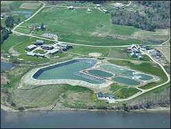
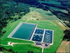
in intervals of the lower Piscataquis River. Paper mills are located
on West Branch at Millinocket and East Millinocket, and on the
main-stem at Lincoln, Old Town, Brewer and Bucksport.
The
Penobscot is home to many fish, including native brook trout,
landlocked salmon, small mouth bass, white perch and chain pickerel
are prevalent resident species. Sea-run species include Atlantic
salmon, alewives, American shad, American eel, sea lamprey, striped
bass, tomcod, rainbow smelt and occasional Atlantic sturgeon.
Most
sea-run species except smelt and eels are found in numbers far below
historic levels because of non-existent or inadequate fish passage
facilities on main-stem and tributaries, past pollution and loss of
habitat due to dam construction.
The
Penobscot is best known for its large historic salmon run (50,000 or
more adults) and its much smaller contemporary run, which is the
largest Atlantic salmon run remaining in the United States
(1,000-4,000 adults in recent decades)